Precipitation time series in Vorarlberg

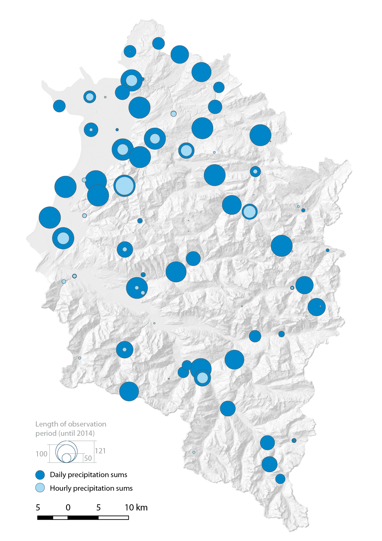
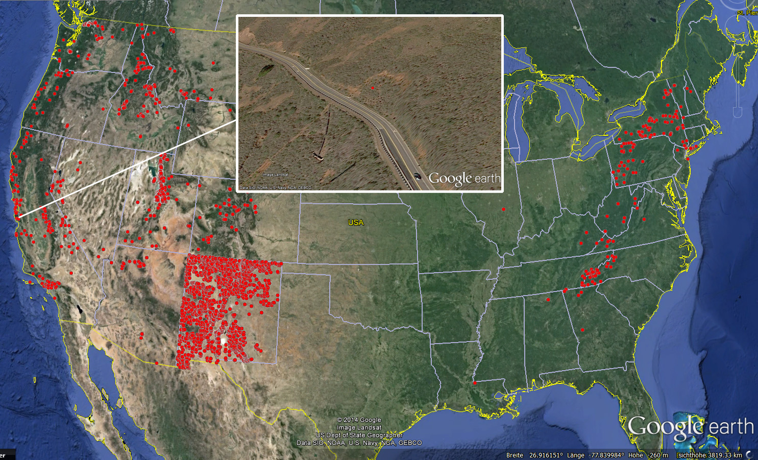
The map below shows the location and length of observation period (until 2015) of 79 rain gauges operated by the Hydrographic Service throughout the state of Vorarlberg (ZAMG gauges not included). The size of the dark blue colored circles indicates the length of the observation period for daily precipitation sums, light blue circles show the same for hourly sums. For the assessment of potentially landslide-triggering amounts of precipitation the time series will be analysed for dated landslide events. We hereby want to thank the Hydrographic Service of Vorarlberg for kindly providing the data.
ns_stat_vbg

Posted in General | Leave a comment

Animation of a landslide-triggering rainfall event in June 2013

The animation below shows the spatio-temporal progression of a landslide-triggering rainfall event from 08:00 a.m. on May 31st to 08:00 a.m. on June 2nd, 2013 for the territory of Vorarlberg, Austria. In the Laternser valley (catchment border in red) where precipitation sums exceeded 250 mm during this period several shallow landslides have been triggered throughout the catchment. The quater-hourly data was provided by our project-partner BOKU-Met.

prec_series_june2013

Posted in General | Leave a comment

Geomorphons Austria

With the help of the GRASS GIS module r.geomorphon a map of principal landform units was calculated for the state territory of Austria. This highly automated classification approach will be applied for the study areas as well in order to compare locations of landslide scars with respective morphological forms. See Jasiewicz and Stepinsky (2013) for more details regarding r.geomorphon.

geomorphons_austria_140_100

Posted in General | Leave a comment

Landslide signs and landuse

Landslides leave distinct signs (“geometric signature”, Pike 1988) in our landscape. However, on intensively cultivated agricultural areas these signs disappear rather quickly. The pictures below taken in South Tyrol near Kaltern this year show a repaired shallow landslide scar. Next year there might be no sign anymore…

comp_landslide_scar_ueberetsch

Posted in General | Leave a comment

Geomorphological map of Laterns

With the help of a geomorphological map of a part of the Laternser valley (courtesy of A.C. Seijmonsbergen, University of Amsterdam) a geotechnical map of homogenous soil units will be created. All laboratory tests, field mappings and geophysical measurements as well as data from respective literature will be included to guarantee an optimal data basis for further simulations. Down below you can see part of the geomorphological map.

geomorph_laterns

Posted in General | Leave a comment

Dynamic penetration tests throughout the Laternser valley

From September 20 to 26 dynamic penetration tests using a lightweight dynamic cone penetrometer (DCP) were conducted throughout the Laternser valley. Combined with geophysics an area-wide soil depth model will be derived. I personally want to stress out the extraordinary commitment of our two BSc-students Leo and Maria in the field dropping the 10kg hammer nearly 30.000 times!
[hana-flv-player video=”http://zieher.cc/blog/media/videos/dcpt.flv”
width=”480″
height=”320″
description=””
player=”1″
autoload=”true” autoplay=”false”
loop=”false” autorewind=”true”
splashimage=”http://zieher.cc/blog/media/bilder/sc_video.png”
/]
In addition sprinkling experiments were repeated under forest cover. Special thanks go to the team of our project partner BfW (Klebinder K. and Sortier B.) as well as Rutzinger M. and Österreicher A. for their assistance in the field. We also want to thank the municipal administration of Laterns for all their great support as well as the ski resort Laterns for providing the water supply.

Posted in General | Leave a comment

Sprinkling experiments in Laterns

From July 22 to 25 sprinkling experiments were conducted in Laterns, Vorarlberg to reproduce and understand infiltration processes during prolonged and intense rainfall. Here you can see a time-lapse of the set-up in the field. Special thanks go to the team of our project partner BfW (Markart G., Sortier B. and Suntinger K.) and Dax V. for providing the photo-equipment. We also want to thank the municipal administration of Laterns as well as the landowner for the great support.
[hana-flv-player video=”http://zieher.cc/blog/media/videos/02_sprinkling_experiment.flv”
width=”480″
height=”320″
description=””
player=”1″
autoload=”true” autoplay=”false”
loop=”false” autorewind=”true”
splashimage=”http://zieher.cc/blog/media/bilder/sc_video.png”
/]

Posted in General | Leave a comment

USGS landslide inventory in Google Earth (TM)

The landslide inventory compiled by Brabb et al. (1999) prepared for Google Earth (TM) allows for exploring the location of landslides (especially debris flows) in the US. The inventory data including 6297 landslide locations throughout the US is available at http://pubs.usgs.gov/mf/1999/2329/. You can download the kmz-file here.

brabb_google

Posted in General | Leave a comment

Sensitivity of pore-pressure evolution to hydraulic diffusivity

The animation below shows changes in pore-pressure evolution and the respective factor of safety at a depth of 2 m resulting from the variation of hydraulic diffusivity. This “scenario” for a representative soil column during the rainfall event back in August 2005 in Vorarlberg, Austria was computed using the physically-based model TRIGRS 2.0.

pwp_reaction

Posted in General | Leave a comment

Avalanche or landslide?

Don’t regard the ski tracks in the lower right part of the picture…

avalanche

Posted in General | Leave a comment