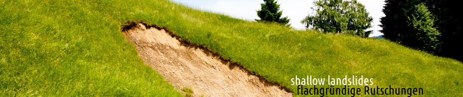
As a first step of any study on landslide susceptibility, hazard or risk a landslide inventory is compiled. In the project C3S-ISLS an inventory focussing on shallow landslides was prepared for the study areas Laternser valley, Kleinwalser valley and the communities Au and Schnepfau in Vorarlberg (Austria). In total more than 2300 shallow landslides have been mapped based on nine sets of high-resolution orthophoto series aided by derivatives of two airborne laser scanning campaigns. The figure below shows an overview of the landslides mapped in the study areas on top of the tectonical map (available on onegeology.org). Especially in the Kleinwalser valley the high susceptibility of the Flysch formation is apparent.

-
Archives
- July 2017
- June 2017
- April 2017
- November 2016
- June 2016
- April 2016
- February 2016
- December 2015
- November 2015
- June 2015
- March 2015
- January 2015
- November 2014
- October 2014
- September 2014
- July 2014
- June 2014
- May 2014
- March 2014
- February 2014
- January 2014
- November 2013
- October 2013
- September 2013
- August 2013
- July 2013
- June 2013
- May 2013
- April 2013
- March 2013
-
Meta